State Route-38 is CLOSED
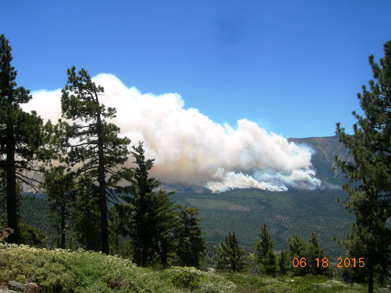

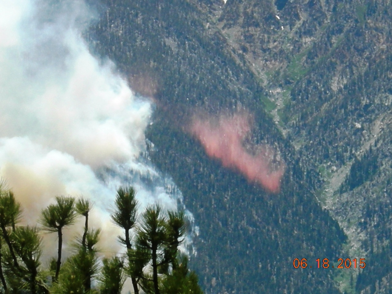
PHOTOS by Jonny Bresnahan at the summit
on Snow Summit’s southside of the Lake Fire in the Jenks Lake area.

From Angelus
Oaks to
Erwin Lake (East
Big Bear City)
Due to the (Jenks
south of SR-38) LAKE FIRE
~~~~~~~~~
ALTERNATIVE ROUTES ADVISED ~
In / Out of Big Bear Valley
State Route 330 Via Highland or
State Route 18 via Lucerne Valley
The LAKE FIRE is officially
7,500 ACRES and 5% Contained
Reported at 11:59 A.M. June 18, 2015
Big Bear Communities are not currently threatened
by the Lake Fire as it is running (southwest) parallel to Big Bear Valley.
4:45 P.M. Thursday Big Bear Lake NewsRoom Photographers'
will have their LAKE Fire Photos Displayed in a Photo Gallery ASAP
Thank You! Editor E T Russell
Lake Fire Update
Friday June 19, 2015 8:00 P.M.
|
Acres Burned:
|
13,000
|
Structures Threatened:
|
500
|
|
Containment:
|
10%
|
Structures Destroyed:
|
0
|
|
Fire Started:
|
June 17, 2015
|
Injuries:
|
0
|
|
Cause:
|
Under Investigation
|
|
|
FRI JUN
19 3:01 P.M.
According to Air Attack, the eastern portion of the fire is southeast of
the Coon Creek Cabin
FRIDAY JUN 19 1:38 A.M.
AT LEAST ONE HELICOPTER CONTINUES TO MAKE DROPS ON THIS FIRE AS THE
GROUND RESOURCES REQUEST THEM. THE HELICOPTER BASE IS AT BIG BEAR AIRPORT.
SOURCE: SCANNER REPORTER:SCMALERT
Friday 6/19 7:00 A.M. (Channel
5 KTLA ) South
of BBL Fire Fighters fought through night.
Dry vegetation fueling the fire, 600 residents evacuated
9:00 A.M. Update the
LAKE Fire has grown to 11,000 acres
Next update will be Friday Evening unless alerted of incident emergency
This commuter alert will
only be updated and emailed during business hours, Monday through Friday, 8:00
A.M. to 5:00 P.M. After-hour updates and
information may be obtained on our Twitter account at caltrans8 -
https://twitter.com/Caltrans8. Caltrans will continue to provide any new information as it is
available concerning road closures. For traffic information
go to our Quickmaps at http://quickmap.dot.ca.gov/.
For fire information go to
http://inciweb.nwcg.gov/incident/4302/.