Caltrans Rule of the
San Bernardino Mountain
Roads
State Routes 38 * 18 * 330
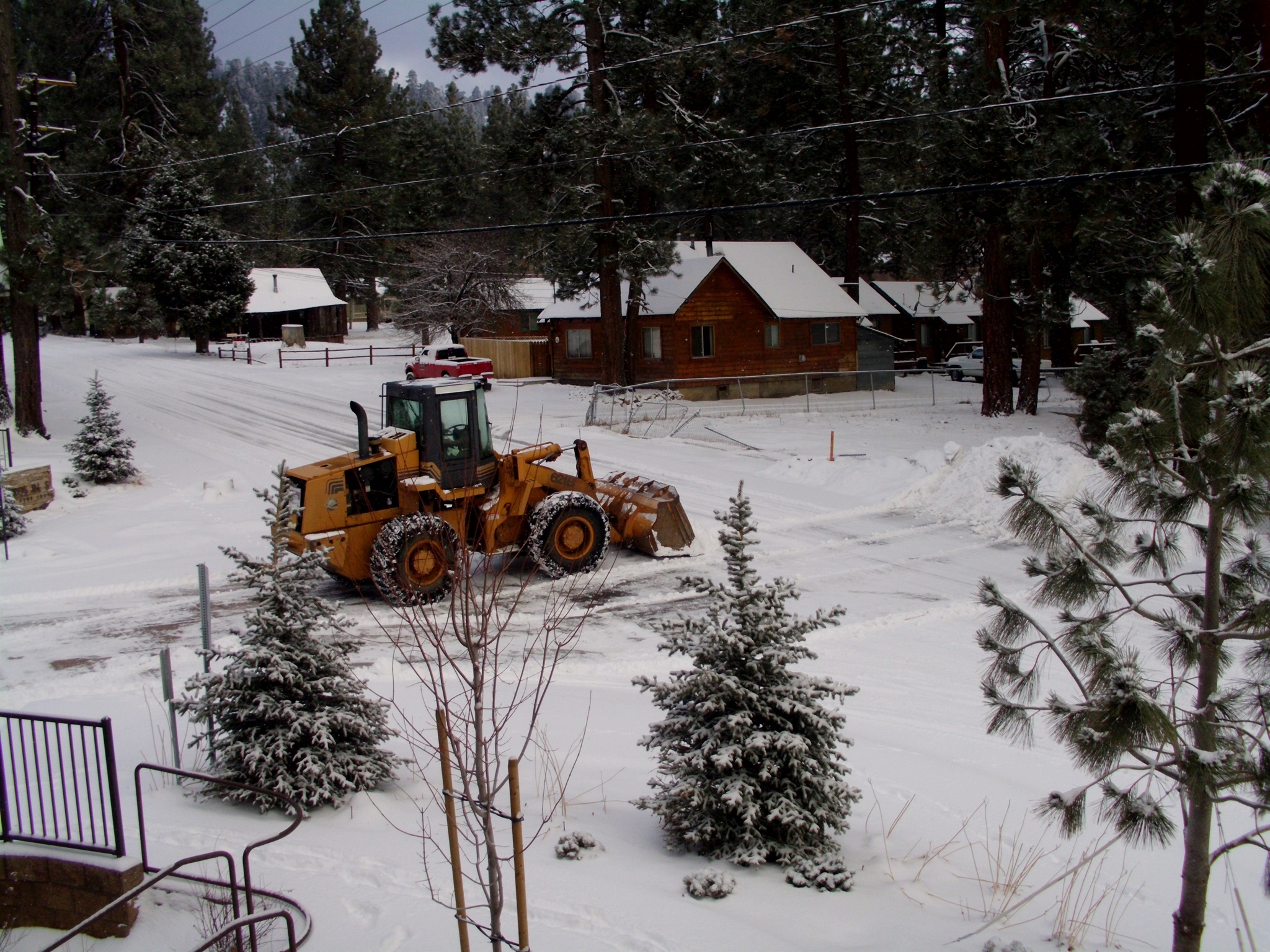
Snow plows began
the tedious work of clearing snow from homes and roads as early as possible.
PHOTO Courtesy of Russell
By E T Russell __
Wednesday January 6, 2016 REPORTS
Socalmountains.com reports –
WED JAN 6, 2016, 1:44
PM
FLASH FLOOD WARNING
INLAND EMPIRE, San Bernardino County
NATIONAL
WEATHER SERVICE in San Diego has
issued a FLASH FLOOD WARNING
For south-eastern
Orange County in South-western California, in Southern California Riverside
County in Southern
California, in Southern California northwestern San Diego County, in Southern
California until 4:30 PM PST - - at 1:30 PM PST - - Doppler Radar depicted a
large area of heavy rain across the warned area in the Inland Empire and
northwest San Diego County.
FLASH FLOODING will
likely begin shortly in dry washed and urban areas.
Burn scar areas will
potentially develop debris flows.
Rainfall rates of
0.50 to 0.75 inches per hour are occurring in the heaviest downpours. Some
locations that will likely experience flooding include: Riverside, San
Bernardino, Moreno Valley,Oceanside, Carlsbad, Temecula, Vista, Mission Viejo,
Redlands and San Clemente.
Wednesday Morning UPDATE:
According to National Weather Service the Mountain
Communities are experiencing the third day of 6-Day Storm System. All San
Bernardino County personnel, Sheriff and Dyeputies, California Highway Patrol,
City of Big Bear Lake Public Works, private snow removal companies, utility/power
companies, plus individual workers met the storm head-on, making travel as much
as possible, on Tuesday. Early this (Wednesday) morning they went back to
meeting Winter’s download, head-on.
TODAY, the NWS reports that in Southern California
the El Niño Episode/Storm will be a severe storm system to move in this
afternoon. Winds of excess of sixty (60) miles per hour will have a combination
of heavy rains with thunder and lighting.
NWS Reminder:
Remember, if you can hear thunder; you are close
enough to be struck by lightning!
http://www.bigbearlake.net/etnews/New-Years-FIRST-WEEK-
A shift in the main storm track is
expected to finally take place early next week. This is more typical of the
storm track during an El Niño episode in which the main storm track is aimed at
southern California and Arizona. A series of storm systems is expected to work
across the area during this time frame. As stated above, confidence is low in
the exact timing and strength of these storm systems as well as exact
precipitation amounts and snow levels. -
January 4th Monday
Morning-Monday Night
●
First storm system possible.
January
6th Wednesday
More down-pour predicted today
Tuesday-Wednesday ●
Likely to be a bigger precipitation event for the entire area compared to the
Monday system. ● May be one defined storm or two separate systems, thus
precipitation could be spread out over a longer period or in shorter breaks. -
Before 7:00 A.M. Tuesday January 5th
Caltrans District 8 declared State Route 18, in the San Bernardino Mountains
required all vehicles, except 4-wheel vehicles with snowtires on all four
wheels; from 5
miles north of the junction of State Route 330 to the Big Bear Dam.
SR-18 (in the Southern California area) is closed at the Los Angeles –
San Bernardino County line, 24 hours a day, 7 days a week through May 31, 2016,
due to construction. A detour is
available.